LOCK 34: Searching for the elusive Lockhouse 34: Today’s search proved to be unsuccessful. It pays to do a little research before you head out the door exploring. I thought I knew this area as I have been to this lovely part of the canal many times before but not searching for lockhouses. It is one of the most beautiful towpaths. I highly recommend visiting. The scenery of the Potomac river is stunning and the historic Harper’s Ferry area is steeped in history.
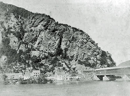
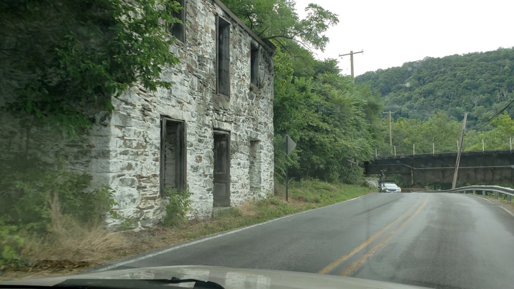
First let’s back up the road to Lock 33 there is an abandoned ruin known as the Stone House and mistakenly called the Salty Dog Saloon, which was in another building. It is the Spencer Store-Elgin House named after a few of its many tenants. At first I thought it was a lockhouse but it was a private residence which changed hands many times. It has been a private residence, a store/saloon and a museum. It was probably used as a hospital during the Civil War. The stone house has a long relationship with the canal. It is easily spotted on Sandy Hook Road at Milepost 60.7. Lock 33 of the Canal was a very busy place of commerce in its heyday because of its proximity to the town of Harpers Ferry which is just across the Potomac river. Because of its location, Lock 33 was surrounded by sheds, stores, taverns and houses. Today there are still a few houses but no commerce. There are many tales of routy, lusty, raucous living at the “Salty Dog Tavern” and the “Stone House” Maybe this is why some of my brother in laws friends jokingly called the residents the “sandy hookers” This little area has had its share of folklore. To read more about Sandy Hook and the Stone House, the Salty Dog Saloon and more see here: http://npshistory.com/publications/choh/lock-33-stone-house-hsr.pdf
I wanted to credit my mother in-law Sylvia Martin who owned the Hillside Motel, our family run motel in Knoxville, MD on Keep Tryst road for helping the folks living in Sandy Hook. As the story goes, there was a serious problem with accessing water there due to pollution and other issues. Soon the water supply would dwindle and the residents would have no recourse but to move. Feeling empathy for these people, Sylvia allowed a water tower to be installed on her land that would feed into the Sandy Hook community. She also allowed a long-time squatter to remain on her land. My mother in-law was known by everyone for her kindness and generosity to all. She raised 11 children,19 grandchildren and 21 great-grandchildren who celebrated every holiday and Sunday dinners at the Hillside. So many wonderful memories there.
The Stonehouse, which is built of Virginia granite still remains but is only a shell of its former self. Another note of interest is John Cook worked here and gathered information about the armory to aid John Brown on his infamous Raid on Harper’s Ferry. The lock sits below Maryland Heights, a high ridge that overlooks Harpers Ferry and very important strategically during the Civil War. I am told the views are beautiful from this trail. See information for trail: https://www.hikingupward.com/omh/marylandheights/
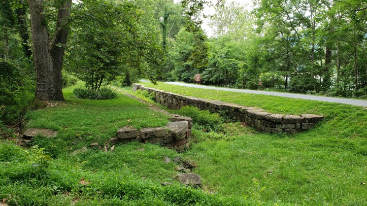
It wasn’t until later after much walking and searching, did I discover why I couldn’t find Lockhouse 34. It was destroyed in the great flood of 1936. The only thing that is left is remnants of the lock, which can be seen at mile 61.5 on the C&O Canal towpath just north of Harpers Ferry. There used to be a small parking lot here but no longer available for parking. In fact, all of the parking spaces along Sandy Hook and Harper’s Ferry road have been blocked off. There is no parking available at all on this road. If you want to walk along the canal there are two places two park. One is at Harper’s Ferry, then you will walk across the impressive railroad bridge. This was always a thrill for my children to cross this bridge. Back then, parking was easier, now the park encourages folks to park at the national park visitor’s center and either walk or take the shuttle down into the town. There is some metered street parking available on Potomac Street if you get there early. The other option is to start further up at the Dargan Bend Boat Ramp which is located just north of Harpers Ferry at Mile 64.9 on the C&O Canal towpath. There is plenty of parking here and a toilet, picnic tables and lovely large open areas of the Potomac River. A favorite place for small boats, kayaks, canoes and tubers. I recommend biking to Harpers Ferry from this area as it is a 3.9 mile walk to Harpers Ferry, but it is well maintained and a lovely stroll with shade trees and views of the Potomac.
Lock 34 was often referred to as “Goodheart’s Lock”. Willard Goodheart was the last locktender at this location. Mr. Goodheart is quoted as saying that he and his family “escaped by boat without our possessions before the house collapsed”. “One of the most devastating of the post canal era floods, the 1936 flood caused major damage throughout the Potomac River Valley”
I found this wonderful vintage silent movie of the Chesapeake & Ohio Canal provided by the National Historic Park : https://youtu.be/Agihv9c_T5M
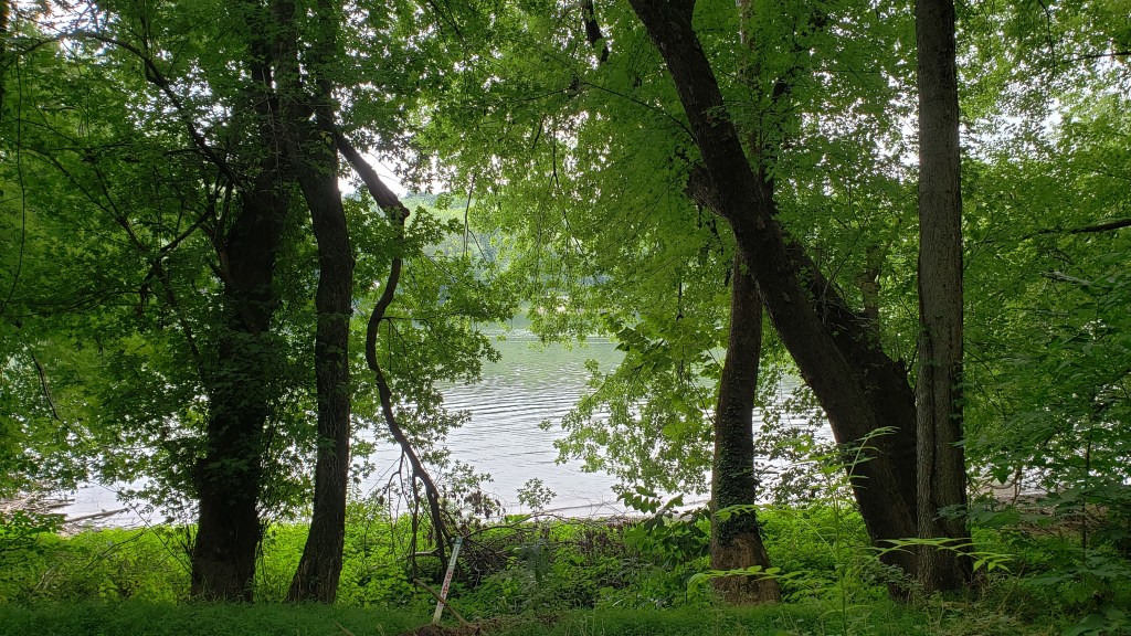
Even though Lockhouse 34 was never to be found, the search was well worth the effort. The beauty along this stretch of the canal is unrivaled.


The photograph below, taken from Harpers Ferry during the Civil War, shows the Potomac River and Maryland Heights. The Salty Dog Tavern and the Stone House.